
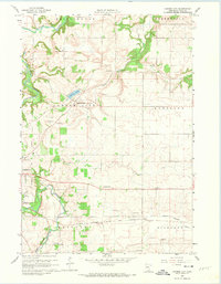
1960 Map of Cannon City
USGS Topo · Published 1961About this map
Cannon City sits at the heart of this landscape, surrounded by the fertile agricultural terrain of Rice County at the dawn of the 1960s. The map illustrates a rural society organized by township boundaries like Wheeling and Walcott, where local education was still anchored by small country institutions such as Wide Awake Sch and Wheeling Sch. The eastern edge of Faribault is visible, marked by the State Hospital and a concentration of industrial activity including several Quarries and Gravel Pits along the Straight River.
Find a feature on this map
28 named features on this map. Tap any name to fly to it.
Don’t see what you’re looking for? This feature index may not catch every label — zoom into the map to look around manually.
Map Details
Editions of this 1960 Cannon City Map
2 editions found
Other maps of this area

1953 · Saint Paul
USGS Topo · 1:250,000

1959 · Saint Paul
USGS Topo · 1:250,000

1960 · Faribault
USGS Topo · 1:24,000

1960 · Northfield
USGS Topo · 1:24,000

1960 · Dennison
USGS Topo · 1:24,000

1960 · Little Chicago
USGS Topo · 1:24,000

1960 · Nerstrand
USGS Topo · 1:24,000

1962 · Medford East
USGS Topo · 1:24,000

1962 · Moland
USGS Topo · 1:24,000

1962 · Medford West
USGS Topo · 1:24,000