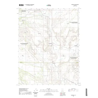
2020 Map of Cannonville
USGS Topo · Published 2020About this map
Tropic, Cannonville, and Henrieville anchor this southern Utah corridor where high plateaus meet the intricate drainage of the Paria River. The 2020 landscape reveals a cluster of settlements defined by their proximity to protected lands, including the eastern edge of Bryce Canyon National Park and the expansive Grand Staircase-Escalante National Monument. Family and community history is anchored at the Cannonville Cem, Henrieville Cem, and Georgetown Cem, while the terrain itself is marked by distinctive geological features like Promise Rock Arch and the Big Bear Geyser.
Find a feature on this map
48 named features on this map. Tap any name to fly to it.
Don’t see what you’re looking for? This feature index may not catch every label — zoom into the map to look around manually.
Map Details
Editions of this 2020 Cannonville Map
This is the sole edition of this map. No revisions or reprints were ever made.
Other maps of this area

1886 · Kanab
USGS Topo · 1:250,000

1886 · Escalante
USGS Topo · 1:250,000

1953 · Cedar City
USGS Topo · 1:250,000

1956 · Escalante
USGS Topo · 1:250,000

1958 · Cedar City
USGS Topo · 1:250,000

1960 · Escalante
USGS Topo · 1:250,000

1962 · Cedar City
USGS Topo · 1:250,000

1964 · Henrieville
USGS Topo · 1:24,000
1964 · Pine Lake
USGS Topo · 1:24,000
1964 · Slickrock Bench
USGS Topo · 1:24,000