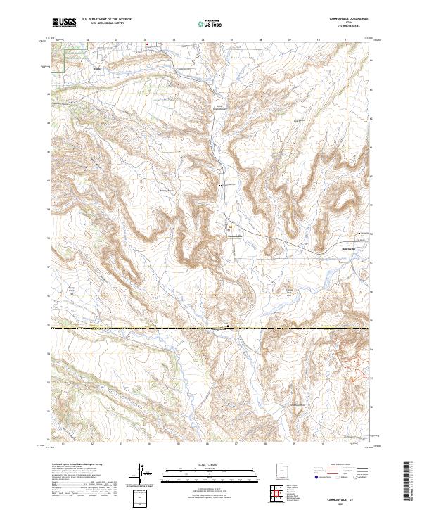
2023 Map of Cannonville
USGS Topo · Published 2023About this map
The Paria River and its various tributaries, including Bryce Creek and Yellow Creek, dictate the settlement patterns of this southern Utah landscape. Long-established communities such as Tropic, Cannonville, and Henrieville are situated along these watercourses, often bordering the expansive Grand Staircase-Escalante National Monument. The map reveals the intricate connection between the topography of benches and hollows, such as Bulldog Bench and Merrill Hollow, and the rural road network including Kodachrome Way and Skutumpah Rd.
Find a feature on this map
49 named features on this map. Tap any name to fly to it.
Don’t see what you’re looking for? This feature index may not catch every label — zoom into the map to look around manually.
Map Details
Editions of this 2023 Cannonville Map
This is the sole edition of this map. No revisions or reprints were ever made.
Other maps of this area

1886 · Kanab
USGS Topo · 1:250,000

1886 · Escalante
USGS Topo · 1:250,000

1953 · Cedar City
USGS Topo · 1:250,000

1956 · Escalante
USGS Topo · 1:250,000

1958 · Cedar City
USGS Topo · 1:250,000

1960 · Escalante
USGS Topo · 1:250,000

1962 · Cedar City
USGS Topo · 1:250,000

1964 · Henrieville
USGS Topo · 1:24,000
1964 · Pine Lake
USGS Topo · 1:24,000
1964 · Slickrock Bench
USGS Topo · 1:24,000