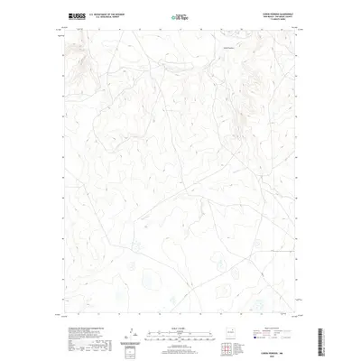
2020 Map of Canon Pedroso
USGS Topo · Published 2020About this map
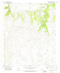
Cañon Pedroso defines this portion of the San Miguel County high country, where the landscape is carved by the winding course of Pedroso Cr. This 2020 survey illustrates a quiet, sparsely developed territory characterized by significant topographic relief and a network of unpaved access routes. The drainage of Pedroso Cr flows through the central and southern portions of the quadrangle, serving as the primary natural landmark in a region where human infrastructure is limited to fundamental transportation corridors. Modern administrative roads like C-53-A and the aptly named Feed Rd provide the only significant markers of land use, likely supporting local ranching or agricultural operations. The map provides a clear look at the intricate contour patterns of the canyon walls and the intermittent water sources that define this New Mexico landscape.
Find a feature on this map
4 named features on this map. Tap any name to fly to it.
Don’t see what you’re looking for? This feature index may not catch every label — zoom into the map to look around manually.
Map Details
Editions of this 2020 Canon Pedroso Map
This is the sole edition of this map. No revisions or reprints were ever made.
Other maps of this area

1892 · Watrous
USGS Topo · 1:125,000

1894 · Watrous
USGS Topo · 1:125,000

1954 · Santa Fe
USGS Topo · 1:250,000

1958 · Santa Fe
USGS Topo · 1:250,000

1964 · Frutosa Lake
USGS Topo · 1:24,000
1966 · Watrous
USGS Topo · 1:24,000
1966 · Cherry Valley Lake
USGS Topo · 1:24,000
1971 · Goetsch Lake
USGS Topo · 1:24,000

1971 · Laguna Huerfana
USGS Topo · 1:24,000
1971 · Canon Pedroso
USGS Topo · 1:24,000