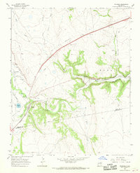
1966 Map of Watrous
USGS Topo · Published 1968About this map
The Santa Fe Trail (Cimarron Cutoff) traces a diagonal path across this high-plains landscape, crossing Wolf Creek and passing near Valmora before the terrain drops toward the canyon floor. At the junction of the Mora River and Sapello River sits the settlement of Watrous, a key point on the Atchison Topeka and Santa Fe railroad. The agricultural development of the valley is evident through an intricate network of irrigation channels, including the Upper Clyde Ditch, Tipton Ditch, and the South Company Ditch. Historical land divisions are marked by the massive John Scolly grant boundary. Genealogists will find interest in the Tiptonville Cem and the settlement of Tiptonville, while the presence of an Old Railroad Grade and several gravel pits indicates the area's industrial and transportation history.
Find a feature on this map
36 named features on this map. Tap any name to fly to it.
Don’t see what you’re looking for? This feature index may not catch every label — zoom into the map to look around manually.
Map Details
Editions of this 1966 Watrous Map
This is the sole edition of this map. No revisions or reprints were ever made.
Other maps of this area

1889 · Las Vegas
USGS Topo · 1:125,000

1891 · Las Vegas
USGS Topo · 1:125,000

1892 · Watrous
USGS Topo · 1:125,000

1893 · Las Vegas
USGS Topo · 1:125,000

1894 · Watrous
USGS Topo · 1:125,000

1954 · Santa Fe
USGS Topo · 1:250,000

1958 · Santa Fe
USGS Topo · 1:250,000

1963 · Fort Union
USGS Topo · 1:24,000
1963 · Loma Parda
USGS Topo · 1:24,000
1963 · Onava
USGS Topo · 1:24,000