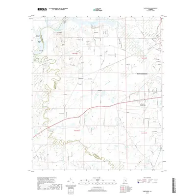
2018 Map of Cantelous
USGS Topo · Published 2018About this map
The Montgomery Regional Airport (Dannelly Field) serves as a primary geographic anchor for this 2018 study of the Alabama landscape southwest of the state capital. The area is defined by the winding course of Pintlala Creek and the broader valley of Catoma Creek, where the terrain transitions from the upland heights of Gunter Hill and Cantelous Hill toward the river bottoms. This modern survey reflects a mix of suburban expansion and traditional land use, noting established settlements like Cantelous and Catoma. Genealogy and local history are preserved in several family-named burial grounds, including Stones Cem, Cantelous Cem, and Davis Cem. Water features are prominent throughout the quadrangle, ranging from the large R E 'Bob' Woodruff Reservoir to the smaller, more isolated Sugarberry Lake and Lake Bowling south of the airport.
Find a feature on this map
120 named features on this map. Tap any name to fly to it.
Don’t see what you’re looking for? This feature index may not catch every label — zoom into the map to look around manually.
Map Details
Editions of this 2018 Cantelous Map
This is the sole edition of this map. No revisions or reprints were ever made.
Other maps of this area

1927 · Montgomery
USGS Topo · 1:48,000

1930 · Montgomery
USGS Topo · 1:62,500

1953 · Montgomery
USGS Topo · 1:250,000

1956 · Montgomery
USGS Topo · 1:250,000

1957 · Montgomery
USGS Topo · 1:250,000

1957 · Letohatchee
USGS Topo · 1:62,500

1957 · Autaugaville
USGS Topo · 1:62,500

1958 · Montgomery
USGS Topo · 1:62,500

1958 · Montgomery North
USGS Topo · 1:24,000

1958 · Montgomery South
USGS Topo · 1:24,000