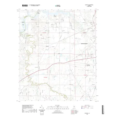
2020 Map of Cantelous
USGS Topo · Published 2020About this map
Pintlala Creek and Catoma Creek dominate the landscape of this southern Alabama region, winding through a terrain defined by low-lying wetlands and established family-named landmarks. The area around Cantelous shows a dense network of local roads such as Cantelou Rd and Cantelou Loop, radiating from Cantelous Hill. To the east, the aviation infrastructure of Montgomery Regional Airport (Dannelly Field) contrasts with the more rural western reaches. Genealogists can find several historic burial grounds preserved on this sheet, including Cantelous Cem, Stones Cem, and the Kindle Baptist Church Memorial Cem. The northern boundary is marked by the Alabama River's meandering course, featuring river-bottom bars like Lower Catoma Bar and O'Possum Bight Bar. Numerous private and named lakes, such as Baggett Lake and Elgin Lake, are scattered across the quadrangle, illustrating the complex hydrology of the Montgomery and Lowndes County border.
Find a feature on this map
105 named features on this map. Tap any name to fly to it.
Don’t see what you’re looking for? This feature index may not catch every label — zoom into the map to look around manually.
Map Details
Editions of this 2020 Cantelous Map
This is the sole edition of this map. No revisions or reprints were ever made.
Other maps of this area

1927 · Montgomery
USGS Topo · 1:48,000

1930 · Montgomery
USGS Topo · 1:62,500

1953 · Montgomery
USGS Topo · 1:250,000

1956 · Montgomery
USGS Topo · 1:250,000

1957 · Montgomery
USGS Topo · 1:250,000

1957 · Letohatchee
USGS Topo · 1:62,500

1957 · Autaugaville
USGS Topo · 1:62,500

1958 · Montgomery
USGS Topo · 1:62,500

1958 · Montgomery North
USGS Topo · 1:24,000

1958 · Montgomery South
USGS Topo · 1:24,000