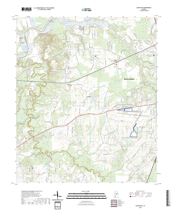
2024 Map of Cantelous
USGS Topo · Published 2024About this map
Pintlala Creek and the meandering Catoma Creek define the landscape west of Montgomery, where the alluvial plains of the Alabama River basin meet the expanding infrastructure of the state capital. The presence of R E 'Bob' Woodruff Reservoir and numerous oxbow features like Jacobs Swamp and Durant Bend reflect the dynamic hydrology of the region. On higher ground, small communities and family-named landmarks such as Cantelous and Gunter Hill persist alongside modern aviation hubs.
Find a feature on this map
121 named features on this map. Tap any name to fly to it.
Don’t see what you’re looking for? This feature index may not catch every label — zoom into the map to look around manually.
Map Details
Editions of this 2024 Cantelous Map
This is the sole edition of this map. No revisions or reprints were ever made.
Other maps of this area

1927 · Montgomery
USGS Topo · 1:48,000

1930 · Montgomery
USGS Topo · 1:62,500

1953 · Montgomery
USGS Topo · 1:250,000

1956 · Montgomery
USGS Topo · 1:250,000

1957 · Montgomery
USGS Topo · 1:250,000

1957 · Letohatchee
USGS Topo · 1:62,500

1957 · Autaugaville
USGS Topo · 1:62,500

1958 · Montgomery
USGS Topo · 1:62,500

1958 · Montgomery North
USGS Topo · 1:24,000

1958 · Montgomery South
USGS Topo · 1:24,000