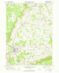
1970 Map of Canton
USGS Topo · Published 1973About this map
Canton serves as the primary hub of activity in this 1970 snapshot of Bradford County, where the Penn Central railroad cuts a north-south path through the valley. The map reveals a landscape defined by sharp elevation changes, from the steep slopes of Armenia Mountain and the Tioga State Forest in the west to the rolling agricultural lands around Windfall and Granville Summit. Local industry is evidenced by various Gravel Pits and a Sandpit scattered near the watercourses.
Find a feature on this map
48 named features on this map. Tap any name to fly to it.
Don’t see what you’re looking for? This feature index may not catch every label — zoom into the map to look around manually.
Map Details
Editions of this 1970 Canton Map
2 editions found
Other maps of this area

1931 · Troy
USGS Topo · 1:48,000

1938 · Troy
USGS Topo · 1:62,500

1939 · Sayre
USGS Topo · 1:62,500

1942 · Sayre
USGS Topo · 1:62,500

1942 · Canton
USGS Topo · 1:62,500

1943 · Powell
USGS Topo · 1:62,500

1944 · Canton
USGS Topo · 1:62,500

1945 · Powell
USGS Topo · 1:62,500

1948 · Sayre
USGS Topo · 1:62,500

1953 · Roseville
USGS Topo · 1:24,000