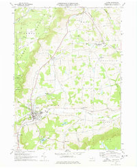
1970 Map of Canton
USGS Topo · Published 1978About this map
Canton serves as the primary hub in this 1970 snapshot of Bradford County, where the Penn Central railroad cuts a north-south path through the valley. The map reveals a landscape defined by the drainage of Towanda Creek and its many tributaries, such as Mill Creek and Alba Creek, which carve through the high ground of Armenia Mountain. To the west, the boundaries of the Tioga State Forest protect the wooded slopes, while the valley floor is dotted with small agricultural settlements like Alba, East Canton, and Granville Summit. Local history and genealogy are well-represented by several burial grounds, including St Michaels Cem and Park Cem, alongside rural landmarks like the Granville Summit North Sch and the secluded Lake Nephawin. The topography illustrates the transition from the dense forests of Tioga County into the valley farms of Pennsylvania's northern tier.
Find a feature on this map
50 named features on this map. Tap any name to fly to it.
Don’t see what you’re looking for? This feature index may not catch every label — zoom into the map to look around manually.
Map Details
Editions of this 1970 Canton Map
2 editions found
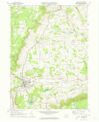
Other maps of this area

1931 · Troy
USGS Topo · 1:48,000

1938 · Troy
USGS Topo · 1:62,500

1939 · Sayre
USGS Topo · 1:62,500

1942 · Sayre
USGS Topo · 1:62,500

1942 · Canton
USGS Topo · 1:62,500

1943 · Powell
USGS Topo · 1:62,500

1944 · Canton
USGS Topo · 1:62,500

1945 · Powell
USGS Topo · 1:62,500

1948 · Sayre
USGS Topo · 1:62,500

1953 · Roseville
USGS Topo · 1:24,000