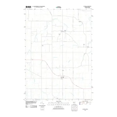
2010 Map of Canton
USGS Topo · Published 2010About this map
Canton serves as the primary hub in this corner of Fillmore County, situated just north of State Line Rd where the Canton Post Office marks the center of local activity. The landscape is defined by the winding course of the South Fork Root River and its tributaries, including Sorenson Creek and Wisel Creek, which carve through the rural countryside. The map reveals a deeply rooted community structure, evidenced by a high density of small cemeteries such as the Amish Cemetery, Henrytown Lutheran Cemetery, and Lenora Cemetery. These burial grounds, along with the scattered settlements of Henrytown, Amherst, and Lenora, provide a precise record of the regional settlement patterns. The agricultural grid is well established, with local thoroughfares like County Hwy-115 and County Hwy-21 connecting these quiet townships across a terrain shaped by the driftless area's intricate drainage systems, including Pine Creek and Frego Creek.
Find a feature on this map
31 named features on this map. Tap any name to fly to it.
Don’t see what you’re looking for? This feature index may not catch every label — zoom into the map to look around manually.
Map Details
Editions of this 2010 Canton Map
This is the sole edition of this map. No revisions or reprints were ever made.
Other maps of this area

1906 · Decorah
USGS Topo · 1:125,000

1954 · Mason City
USGS Topo · 1:250,000

1957 · Mason City
USGS Topo · 1:250,000

1958 · Mason City
USGS Topo · 1:250,000

1958 · La Crosse
USGS Topo · 1:250,000

1961 · La Crosse
USGS Topo · 1:250,000

1965 · La Crosse
USGS Topo · 1:250,000

1965 · Harmony
USGS Topo · 1:24,000

1965 · Mabel
USGS Topo · 1:24,000

1965 · Canton
USGS Topo · 1:24,000