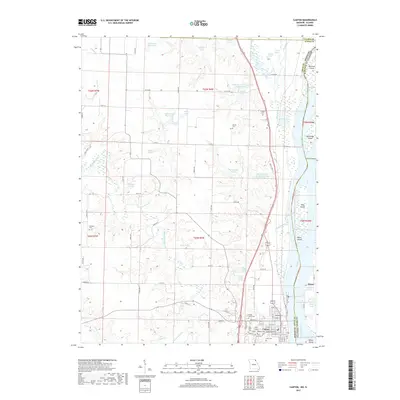
2017 Map of Canton
USGS Topo · Published 2017About this map
Canton serves as a significant riverfront settlement along the west bank of the Mississippi River, where the landscape is defined by the complex hydrology of the Canton Chute and numerous river islands. The town is anchored by the presence of Culver - Stockton Coll, situated on Coll Hill overlooking the urban grid. The surrounding terrain in Lewis County is marked by a dense network of small lakes and ponds, such as Uhlmeyer Lake and Bruns Lake, alongside the meandering paths of the Wyaconda River and Sugar Cr. This area shows a high concentration of local family and community history preserved in sites like Forest Grove Cem, Oak Bluff Cem, and Hardin Cem. Across the river in Illinois, the settlement of Meyer stands near Martin Lake, illustrating the close relationship between these shoreline communities even as they are separated by the state line and the river's major channels.
Find a feature on this map
99 named features on this map. Tap any name to fly to it.
Don’t see what you’re looking for? This feature index may not catch every label — zoom into the map to look around manually.
Map Details
Editions of this 2017 Canton Map
This is the sole edition of this map. No revisions or reprints were ever made.
Other maps of this area

1903 · Kahoka
USGS Topo · 1:125,000

1936 · Keokuk
USGS Topo · 1:62,500

1946 · Mendon
USGS Topo · 1:62,500

1948 · Mendon
USGS Topo · 1:62,500

1949 · Kahoka SE
USGS Topo · 1:24,000

1949 · St. Patrick
USGS Topo · 1:24,000

1950 · Saint Patrick
USGS Topo · 1:24,000

1950 · Kahoka SE
USGS Topo · 1:24,000

1950 · Keokuk
USGS Topo · 1:62,500

1950 · La Grange
USGS Topo · 1:24,000