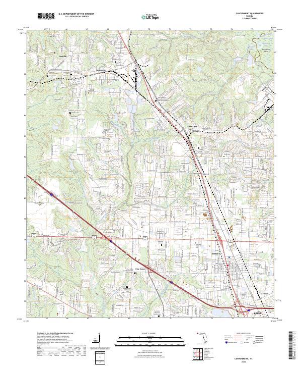
2024 Map of Cantonment
USGS Topo · Published 2024About this map
The Escambia River defines the eastern boundary of this West Florida landscape, where the communities of Cantonment and Gonzalez sit atop the high ground above the river's low-lying wetlands. A high concentration of institutional and family burial sites marks this area's long-established local history, ranging from the Farm Hill United Methodist Church Cem in the north to the Pensacola Memorial Gardens Cem near the southern edge. The map reveals a transition from industrial and residential clusters near the rail corridors and major thoroughfares like S Hwy 97 and Interstate 10 to the more dispersed settlements of Farm Hill and Pine Forest. Researchers will find a distinct pattern of small lakes and creeks, such as Becks Lake and Elevenmile Creek, which have historically dictated the placement of roads and homesteads between the river and the inland pine woods.
Find a feature on this map
40 named features on this map. Tap any name to fly to it.
Don’t see what you’re looking for? This feature index may not catch every label — zoom into the map to look around manually.
Map Details
Editions of this 2024 Cantonment Map
This is the sole edition of this map. No revisions or reprints were ever made.
Other maps of this area

1920 · Milton
USGS Topo · 1:62,500

1921 · Pensacola
USGS Topo · 1:62,500

1921 · Fort Barrancas
USGS Topo · 1:62,500

1921 · Muscogee
USGS Topo · 1:62,500

1941 · Fort Barrancas
USGS Topo · 1:62,500

1941 · Muscogee
USGS Topo · 1:62,500

1941 · Pensacola
USGS Topo · 1:62,500

1941 · Milton
USGS Topo · 1:62,500

1942 · Pensacola
USGS Topo · 1:62,500

1943 · Muscogee
USGS Topo · 1:62,500