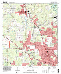
1994 Map of Cantonment
USGS Topo · Published 2000About this map
Industrial waste ponds and sewage disposal facilities dominate the central corridor of this Florida landscape, illustrating the heavy utility and manufacturing footprint near Cantonment in the mid-1990s. The Louisville and Nashville railroad runs southeast through the heart of the area, connecting the industrial sectors of Gonzalez and Ensley. This infrastructure is set against a backdrop of small residential pockets and numerous local institutions, including Ransom Sch and Pine Meadow Sch.
Find a feature on this map
65 named features on this map. Tap any name to fly to it.
Don’t see what you’re looking for? This feature index may not catch every label — zoom into the map to look around manually.
Map Details
Editions of this 1994 Cantonment Map
This is the sole edition of this map. No revisions or reprints were ever made.
Other maps of this area

1920 · Milton
USGS Topo · 1:62,500

1921 · Pensacola
USGS Topo · 1:62,500

1921 · Fort Barrancas
USGS Topo · 1:62,500

1921 · Muscogee
USGS Topo · 1:62,500

1941 · Fort Barrancas
USGS Topo · 1:62,500

1941 · Muscogee
USGS Topo · 1:62,500

1941 · Pensacola
USGS Topo · 1:62,500

1941 · Milton
USGS Topo · 1:62,500

1942 · Pensacola
USGS Topo · 1:62,500

1943 · Muscogee
USGS Topo · 1:62,500