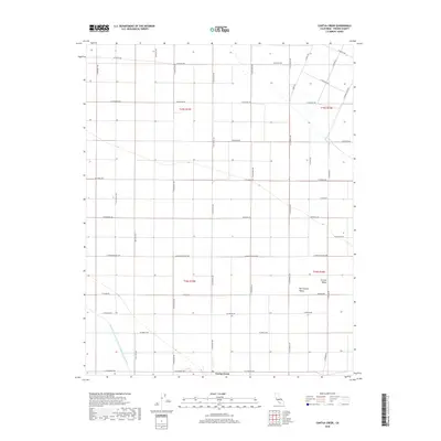
2018 Map of Cantua Creek
USGS Topo · Published 2018About this map
Cantua Creek serves as a focal point in this portion of the Central Valley, where a rigorous grid of agricultural roads defines the landscape. The most prominent engineering feature is the Governor Edmund G Brown California Aqueduct, which cuts diagonally through the southwestern quadrant, illustrating the massive scale of water infrastructure required for farming in the San Joaquin Valley. The map reveals a highly structured rural environment, where long arterial roads like W Manning Ave and W Mountain View Ave stretch across the flat terrain, connecting dispersed homesteads and industrial agricultural operations. Names like S Oil City Ave hint at the region's diverse economic history, while the systematic naming of North-South avenues after California counties—such as Tuolumne, Calaveras, and San Mateo—underscores the organized planning of this fertile interior.
Find a feature on this map
37 named features on this map. Tap any name to fly to it.
Don’t see what you’re looking for? This feature index may not catch every label — zoom into the map to look around manually.
Map Details
Editions of this 2018 Cantua Creek Map
This is the sole edition of this map. No revisions or reprints were ever made.
Other maps of this area

1912 · Coalinga
USGS Topo · 1:125,000

1922 · Tufts Ranch
USGS Topo · 1:31,680

1923 · Levis
USGS Topo · 1:31,680

1923 · Englebrecht Ranch
USGS Topo · 1:31,680

1924 · Jamesan
USGS Topo · 1:31,680

1924 · Tranquillity
USGS Topo · 1:31,680

1925 · San Joaquin
USGS Topo · 1:31,680

1931 · Towne Oil Station
USGS Topo · 1:31,680

1931 · Mouth of Cantua Creek
USGS Topo · 1:31,680

1943 · Joaquin Rocks
USGS Topo · 1:62,500