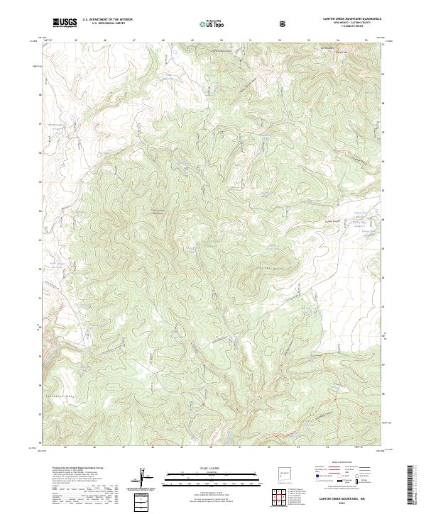
2023 Map of Canyon Creek Mountains
USGS Topo · Published 2023About this map
The Canyon Creek Mountains define this high-elevation landscape within the Gila National Forest, where steep drainages and isolated peaks dictate the movement of water and travel. The terrain is characterized by a sophisticated network of livestock tanks and springs, such as Scrub Oak Tank, Prospector Tank, and Little Turkey Spring, essential for land management in this arid New Mexico environment.
Find a feature on this map
52 named features on this map. Tap any name to fly to it.
Don’t see what you’re looking for? This feature index may not catch every label — zoom into the map to look around manually.
Map Details
Editions of this 2023 Canyon Creek Mountains Map
This is the sole edition of this map. No revisions or reprints were ever made.
Other maps of this area

1911 · Alum Mountain
USGS Topo · 1:125,000

1913 · Alum Mountain
USGS Topo · 1:125,000

1918 · Pelona
USGS Topo · 1:125,000

1954 · Clifton
USGS Topo · 1:250,000

1957 · Clifton
USGS Topo · 1:250,000

1958 · Clifton
USGS Topo · 1:250,000

1962 · Clifton
USGS Topo · 1:250,000
1963 · Loco Mountain
USGS Topo · 1:24,000
1963 · Pitchfork Canyon
USGS Topo · 1:24,000
1965 · Canyon Creek Mountains
USGS Topo · 1:24,000