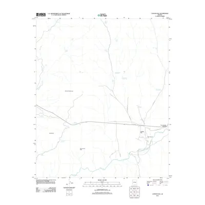
2011 Map of Canyon Day
USGS Topo · Published 2011About this map
White River frontage and the convergence of local routes define the community of Canyon Day in the early 21st century. The settlement sits at the junction of Indian Rte 41 and Indian Rte 47, leading toward the nearby Fort Apache Junction. The landscape is shaped by significant geological features including the prominent Sawtooth Mountain, Kelly Butte, and the distinctively named Tsay-se-zhin Butte.
Find a feature on this map
34 named features on this map. Tap any name to fly to it.
Don’t see what you’re looking for? This feature index may not catch every label — zoom into the map to look around manually.
Map Details
Editions of this 2011 Canyon Day Map
This is the sole edition of this map. No revisions or reprints were ever made.
Other maps of this area

1954 · Clifton
USGS Topo · 1:250,000

1954 · Mesa
USGS Topo · 1:250,000

1957 · Mesa
USGS Topo · 1:250,000

1957 · Clifton
USGS Topo · 1:250,000

1958 · Clifton
USGS Topo · 1:250,000

1958 · Mesa
USGS Topo · 1:250,000

1960 · Mesa
USGS Topo · 1:250,000

1962 · Clifton
USGS Topo · 1:250,000

1964 · Mesa
USGS Topo · 1:250,000
1966 · Forks Butte
USGS Topo · 1:24,000