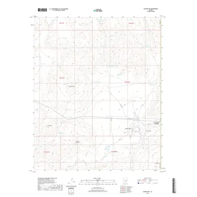
2018 Map of Canyon Day
USGS Topo · Published 2018About this map
Canyon Day serves as a primary residential center in this high-desert landscape, situated along the winding course of the White River. The settlement is defined by a grid of local streets like S Tumbleweed St and S East St, while the surrounding terrain is dominated by prominent volcanic and geological landmarks. Elevations rise toward Sawtooth Mtn and Sevenmile Rim, with individual formations such as Kelly Butte and Tsay-se-zhin Butte rising from the plateau.
Find a feature on this map
48 named features on this map. Tap any name to fly to it.
Don’t see what you’re looking for? This feature index may not catch every label — zoom into the map to look around manually.
Map Details
Editions of this 2018 Canyon Day Map
This is the sole edition of this map. No revisions or reprints were ever made.
Other maps of this area

1954 · Clifton
USGS Topo · 1:250,000

1954 · Mesa
USGS Topo · 1:250,000

1957 · Mesa
USGS Topo · 1:250,000

1957 · Clifton
USGS Topo · 1:250,000

1958 · Clifton
USGS Topo · 1:250,000

1958 · Mesa
USGS Topo · 1:250,000

1960 · Mesa
USGS Topo · 1:250,000

1962 · Clifton
USGS Topo · 1:250,000

1964 · Mesa
USGS Topo · 1:250,000
1966 · Forks Butte
USGS Topo · 1:24,000