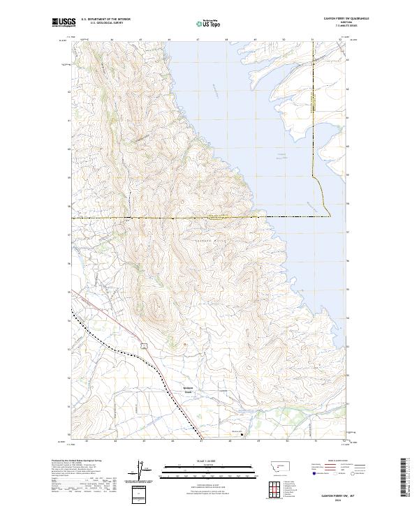
2024 Map of Canyon Ferry SW
USGS Topo · Published 2024About this map
Spokane Hills dominate the central landscape of this Broadwater County region, where the high ridges give way to the expansive waters of Canyon Ferry Lake. This modern topography illustrates the complex interface between the high desert terrain and the managed waters of the Missouri River. The map detailing this area shows a network of local roads such as Rose Quartz Rd and Jiminy Green Rd that wind through the draws and foothills, indicating contemporary residential development in a historically significant mining and ranching corridor.
Find a feature on this map
32 named features on this map. Tap any name to fly to it.
Don’t see what you’re looking for? This feature index may not catch every label — zoom into the map to look around manually.
Map Details
Editions of this 2024 Canyon Ferry SW Map
This is the sole edition of this map. No revisions or reprints were ever made.
Other maps of this area

1886 · Fort Logan
USGS Topo · 1:250,000

1948 · White Sulphur Springs
USGS Topo · 1:250,000

1950 · Canyon Ferry
USGS Topo · 1:62,500

1950 · Townsend
USGS Topo · 1:62,500

1950 · East Helena
USGS Topo · 1:62,500

1950 · Clancy
USGS Topo · 1:62,500

1958 · White Sulphur Springs
USGS Topo · 1:250,000

1961 · White Sulphur Springs
USGS Topo · 1:250,000

1965 · White Sulphur Springs
USGS Topo · 1:250,000
1972 · Hauser Lake
USGS Topo · 1:24,000