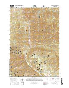
2017 Map of Canyon Mountain
USGS Topo · Published 2017About this map
Malheur National Forest dominates this section of the Strawberry Range and Aldrich Mountains, where the landscape is defined by steep drainages and isolated springs. The complex hydrology of the high country is evidenced by features like Rattlesnake Spring and Maiden Spring, which feed into the Canyon Cr watershed. A notable administrative boundary includes the Canyon City Municipal Watershed, protecting local water sources near Little Canyon Mtn. Genealogists and local historians can trace the geography of old homesteading and ranching sites through family-named landmarks such as Byram Gulch, Watson Gulch, and Jack Cabin Meadow. These names reflect the early settlement patterns in this part of Grant County, where access to water and grazing land at spots like Horseshoe Bar and Guernsey Pond was vital for mountain life.
Find a feature on this map
67 named features on this map. Tap any name to fly to it.
Don’t see what you’re looking for? This feature index may not catch every label — zoom into the map to look around manually.
Map Details
Editions of this 2017 Canyon Mountain Map
This is the sole edition of this map. No revisions or reprints were ever made.
Other maps of this area

1940 · Mount Vernon
USGS Topo · 1:62,500

1940 · John Day
USGS Topo · 1:62,500

1943 · John Day
USGS Topo · 1:62,500

1943 · Mount Vernon
USGS Topo · 1:62,500

1955 · Canyon City
USGS Topo · 1:250,000

1959 · Canyon City
USGS Topo · 1:250,000

1961 · Logdell
USGS Topo · 1:62,500

1961 · Seneca
USGS Topo · 1:62,500

1972 · John Day
USGS Topo · 1:24,000

1972 · Canyon Mtn
USGS Topo · 1:24,000