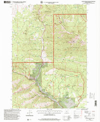
1998 Map of Canyon Mountain
USGS Topo · Published 2000About this map
Mining operations and high-elevation relief define this section of the Strawberry Range within the Malheur National Forest. The presence of Dredge Tailings near Eagle Peak Comm Facility and multiple lode sites like the Golden West Mine and Iron King Mine indicate a landscape heavily shaped by mineral extraction. These prospects follow the steep drainages of Canyon Creek and its many gulches, while the eastern portion of the sheet transitions into the protected Strawberry Mountain Wilderness.
Find a feature on this map
65 named features on this map. Tap any name to fly to it.
Don’t see what you’re looking for? This feature index may not catch every label — zoom into the map to look around manually.
Map Details
Editions of this 1998 Canyon Mountain Map
This is the sole edition of this map. No revisions or reprints were ever made.
Other maps of this area

1940 · Mount Vernon
USGS Topo · 1:62,500

1940 · John Day
USGS Topo · 1:62,500

1943 · John Day
USGS Topo · 1:62,500

1943 · Mount Vernon
USGS Topo · 1:62,500

1955 · Canyon City
USGS Topo · 1:250,000

1959 · Canyon City
USGS Topo · 1:250,000

1961 · Logdell
USGS Topo · 1:62,500

1961 · Seneca
USGS Topo · 1:62,500

1972 · John Day
USGS Topo · 1:24,000

1972 · Canyon Mtn
USGS Topo · 1:24,000