
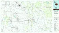
1966 Map of Cap Rock
USGS Topo · Published 1968About this map
Indian Ridge and the dramatic Escarpment dominated the landscape of the Texas Panhandle in the mid-1960s, marking the transition from the high plains to the broken canyonlands below. The Forbes Oil Field and numerous scattered Oil Wells indicate the intensity of petroleum exploration during this era, while a private Landing Strip and isolated Pumping Sta reflect the remote operational needs of the region. The drainage systems are particularly complex here, where the North Fork Brazos River, Double Mountain Fork Brazos River, and Salt Fork Brazos River begin their descent. Small-scale industrial activity is evident through various Gravel Pits and a Claypit, while the settlement of Cap Rock sits atop the plateau near a utility Substation. The boundary between Crosby Co and Garza Co runs through these rugged breaks, where landmarks like Courthouse Mtn served as essential navigational points for locals.
Find a feature on this map
25 named features on this map. Tap any name to fly to it.
Don’t see what you’re looking for? This feature index may not catch every label — zoom into the map to look around manually.
Map Details
Editions of this 1966 Cap Rock Map
This is the sole edition of this map. No revisions or reprints were ever made.
Other maps of this area

1954 · Lubbock
USGS Topo · 1:250,000

1965 · Acuff
USGS Topo · 1:24,000

1965 · Southland
USGS Topo · 1:24,000

1965 · Slaton NE
USGS Topo · 1:24,000

1966 · Canyon Valley
USGS Topo · 1:24,000

1967 · Ralls SE
USGS Topo · 1:24,000

1967 · Savage
USGS Topo · 1:24,000

1968 · South Dokegood Creek
USGS Topo · 1:24,000

1969 · Cap Rock SE
USGS Topo · 1:24,000
1986 · Slaton
USGS Topo · 1:100,000