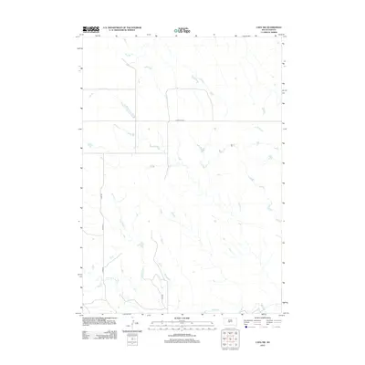
2012 Map of Capa NW
USGS Topo · Published 2012About this map
Bad River flows through the southeastern corner of this Jones County landscape, marking a primary drainage point for the surrounding prairie. This area of central South Dakota is defined by a network of seasonal drainages and creek beds, including the winding course of Big Prairie Dog Cr. The terrain's few structures are connected by a sparse grid of rural routes such as Copperline Rd and Capa Rd, reflecting the expansive and open character of the region's ranching or agricultural land. The map illustrates the minimal infrastructure typical of the high plains, where named county roads like Co Rd-N1 and Co Rd-N3 provide the primary means of navigation through the extensive drainage basins.
Find a feature on this map
7 named features on this map. Tap any name to fly to it.
Don’t see what you’re looking for? This feature index may not catch every label — zoom into the map to look around manually.
Map Details
Editions of this 2012 Capa NW Map
This is the sole edition of this map. No revisions or reprints were ever made.
Other maps of this area

1951 · Capa
USGS Topo · 1:24,000

1951 · Van Metre
USGS Topo · 1:24,000

1951 · Capa NW
USGS Topo · 1:24,000

1951 · Capa SE
USGS Topo · 1:24,000

1954 · Midland SE
USGS Topo · 1:24,000

1954 · Pierre
USGS Topo · 1:250,000

1958 · Pierre
USGS Topo · 1:250,000
1982 · Doty Ridge
USGS Topo · 1:24,000

1982 · Hayes South
USGS Topo · 1:24,000

1982 · Hohrman Ranch
USGS Topo · 1:24,000