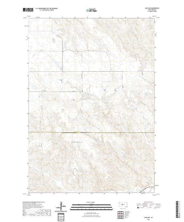
2021 Map of Capa NW
USGS Topo · Published 2021About this map
The Bad River and its complex network of seasonal drainages define the landscape of the South Dakota prairie in the early 21st century. This survey documents the boundary between Stanley and Jones Counties, illustrating a region dominated by vast open range and cattle-country infrastructure. Travel across the plains is traced through a grid of rural routes such as Capa Rd and Bad River Rd, which follow the contours of the breaks and plateaus. Smaller waterways like Big Prairie Dog Cr provide critical drainage points in a terrain marked by dramatic elevation changes. The map reveals the persistence of the Public Land Survey System, with township and range lines like t3n r26e and t3n r27e providing the primary structure for land ownership and management in this sparsely populated portion of the Great Plains.
Find a feature on this map
18 named features on this map. Tap any name to fly to it.
Don’t see what you’re looking for? This feature index may not catch every label — zoom into the map to look around manually.
Map Details
Editions of this 2021 Capa NW Map
This is the sole edition of this map. No revisions or reprints were ever made.
Other maps of this area

1951 · Capa
USGS Topo · 1:24,000

1951 · Van Metre
USGS Topo · 1:24,000

1951 · Capa NW
USGS Topo · 1:24,000

1951 · Capa SE
USGS Topo · 1:24,000

1954 · Midland SE
USGS Topo · 1:24,000

1954 · Pierre
USGS Topo · 1:250,000

1958 · Pierre
USGS Topo · 1:250,000
1982 · Doty Ridge
USGS Topo · 1:24,000

1982 · Hayes South
USGS Topo · 1:24,000

1982 · Hohrman Ranch
USGS Topo · 1:24,000