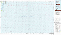
1984 Map of Cape Fear
USGS Topo · Published 1985About this map
Fort Fisher State Historic Site and the surrounding coastal defenses define this mid-1980s look at the strategic mouth of the Cape Fear River. The map details a landscape heavily influenced by both military presence and the shifting geography of the Carolina coast, featuring the Military Ocean Terminal Sunny Point on the western bank and Fort Fisher Air Force Sta near Federal Point.
Find a feature on this map
24 named features on this map. Tap any name to fly to it.
Don’t see what you’re looking for? This feature index may not catch every label — zoom into the map to look around manually.
Map Details
Editions of this 1984 Cape Fear Map
This is the sole edition of this map. No revisions or reprints were ever made.
Other maps of this area

1942 · Wilmington
USGS Topo · 1:62,500

1942 · Cape Fear
USGS Topo · 1:24,000

1943 · Funston
USGS Topo · 1:24,000

1946 · Southport
USGS Topo · 1:24,000

1946 · Snow Marsh
USGS Topo · 1:24,000

1948 · Wilmington
USGS Topo · 1:62,500

1949 · Georgetown
USGS Topo · 1:250,000

1953 · Florence
USGS Topo · 1:250,000

1953 · Beaufort
USGS Topo · 1:250,000

1954 · Florence
USGS Topo · 1:250,000