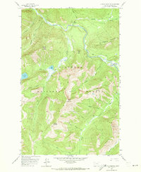
1958 Map of Capitol Mountain
USGS Topo · Published 1973About this map
Middle Fork Flathead River serves as the central artery for this portion of the Flathead National Forest, winding past the remote landing and wilderness outpost of Schafer Meadows. The landscape is defined by its extreme verticality, with high summits like Union Mountain and Capitol Mountain looking down upon a dense web of alpine drainage systems. Small, high-elevation bodies of water such as Scott Lake and Flotilla Lake are perched among the ridges, accessible only by a network of established Pack Trails.
Find a feature on this map
30 named features on this map. Tap any name to fly to it.
Don’t see what you’re looking for? This feature index may not catch every label — zoom into the map to look around manually.
Map Details
Editions of this 1958 Capitol Mountain Map
4 editions found
Other maps of this area

1913 · Marias Pass
USGS Topo · 1:125,000

1936 · Silvertip
USGS Topo · 1:96,000

1942 · Silvertip
USGS Topo · 1:125,000

1955 · Choteau
USGS Topo · 1:250,000

1957 · Choteau
USGS Topo · 1:250,000

1958 · Choteau
USGS Topo · 1:250,000

1958 · Red Plume Mountain
USGS Topo · 1:24,000

1958 · Gable Peaks
USGS Topo · 1:24,000

1958 · Capitol Mountain
USGS Topo · 1:24,000

1958 · Crescent Cliff
USGS Topo · 1:24,000