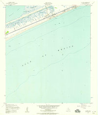
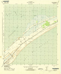
1954 Map of Caplen
USGS Topo · Published 1958About this map
Bolivar Peninsula stretches between the Gulf of Mexico and East Bay in this mid-1950s survey, revealing a landscape defined by coastal industry and navigation. The Intracoastal Waterway cuts a straight line through the salt marshes, reaching a project depth of 12 feet to facilitate marine traffic north of the small settlements of Caplen and Patton. This era of the peninsula is characterized by active petroleum extraction, with numerous Oil Wells, Oil Tanks, and a prominent Oil Derrick clustered near the shoreline. Local geography is intricately detailed with naming for Yates Cove, Crab Lake, and Big Pasture Bayou, providing a clear record of the tidal terrain before modern coastal development altered the footprint of these small Gulf communities.
Find a feature on this map
19 named features on this map. Tap any name to fly to it.
Don’t see what you’re looking for? This feature index may not catch every label — zoom into the map to look around manually.
Map Details
Editions of this 1954 Caplen Map
4 editions found
Other maps of this area

1931 · Flake
USGS Topo · 1:24,000

1931 · High Island
USGS Topo · 1:24,000

1931 · Frozen Point
USGS Topo · 1:24,000

1933 · Frozen Point
USGS Topo · 1:31,680

1933 · Caplen
USGS Topo · 1:31,680

1933 · The Jetties
USGS Topo · 1:31,680

1933 · Whites Lake
USGS Topo · 1:31,680

1933 · Flake
USGS Topo · 1:31,680

1943 · High Island
USGS Topo · 1:31,680
1943 · Flake
USGS Topo · 1:25,000