1939 Map of Caplinger Mills
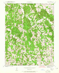
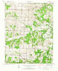
USGS Topo · Published 1967About this map
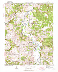
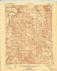
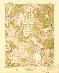
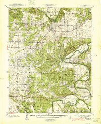
The Sac River winds through a landscape defined by small-scale agriculture and early rural infrastructure in this late 1930s survey of the Washington township area. The settlement at Caplinger Mills serves as a focal point along the river, illustrating the historical importance of water-powered industry in Cedar County. Away from the riverbanks, the terrain is dotted with an unusually dense network of one-room schoolhouses, including Flatrock Sch, Cline Hill Sch, and Bluff Springs Sch, which suggest a well-populated rural community before the mid-century trend toward school consolidation.
Find a feature on this map
40 named features on this map. Tap any name to fly to it.
Don’t see what you’re looking for? This feature index may not catch every label — zoom into the map to look around manually.
Map Details
Editions of this 1939 Caplinger Mills Map
4 editions found
Other maps of this area

1886 · Stockton
USGS Topo · 1:125,000

1937 · Tiffin
USGS Topo · 1:31,680
1938 · Roscoe
USGS Topo · 1:24,000
1938 · Vista
USGS Topo · 1:24,000
1939 · Caplinger Mills
USGS Topo · 1:24,000
1939 · Arnica
USGS Topo · 1:24,000
1939 · Filley
USGS Topo · 1:24,000
1940 · Roscoe
USGS Topo · 1:24,000
1940 · Filley
USGS Topo · 1:24,000
1940 · Vista
USGS Topo · 1:24,000