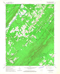
1965 Map of Capon Springs
USGS Topo · Published 1967About this map
Cacapon River winds through the western valley of this 1960s terrain, anchoring a landscape defined by the parallel ridges of Kale Mountain, Timber Ridge, and Great North Mountain. This borderland between West Virginia and Virginia was a destination for recreation and rural community life, featuring several youth camps such as Camp White Mtn and Camp Tall Timbers. The famous resort area at Capon Springs is visible in the southwest, complete with its Golf Course and adjacent Himmelwright Ridge.
Find a feature on this map
64 named features on this map. Tap any name to fly to it.
Don’t see what you’re looking for? This feature index may not catch every label — zoom into the map to look around manually.
Map Details
Editions of this 1965 Capon Springs Map
2 editions found
Other maps of this area

1891 · Romney
USGS Topo · 1:125,000

1894 · Winchester
USGS Topo · 1:125,000

1916 · Capon Bridge
USGS Topo · 1:62,500

1921 · Hanging Rock
USGS Topo · 1:48,000

1922 · Wardensville
USGS Topo · 1:62,500

1923 · Middletown
USGS Topo · 1:62,500

1923 · Capon Bridge
USGS Topo · 1:62,500

1923 · Hanging Rock
USGS Topo · 1:62,500

1924 · Wardensville
USGS Topo · 1:62,500

1937 · Capon Bridge
USGS Topo · 1:48,000