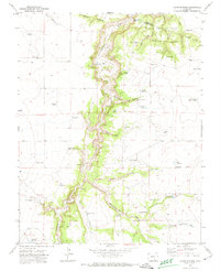
1970 Map of Capps Springs
USGS Topo · Published 1974About this map
The Cucharas River carves a deep, winding path through this corner of Huerfano and Pueblo counties, defining the character of the landscape within the Vigil and St Vrain grant. This 1970 field survey captures a high-desert ranching environment where water management was the primary driver of development, evidenced by the numerous reservoirs and wells such as Wyatt Reservoir, Lauer Deus Lake, and the Albright Well. The presence of the Pack Trail near Wilson Crossing and the Sheep Crossing further south highlights the traditional movement of livestock through the drainage. Settlement is sparse, anchored by the Kenner Ranch and local landmarks like Tryon, while the surrounding geography is dominated by prominent landforms like Turkey Ridge and a series of rugged canyons including Emma Paul Canyon and Rattlesnake Canyon.
Find a feature on this map
55 named features on this map. Tap any name to fly to it.
Don’t see what you’re looking for? This feature index may not catch every label — zoom into the map to look around manually.
Map Details
Editions of this 1970 Capps Springs Map
2 editions found
Other maps of this area

1891 · Walsenburg
USGS Topo · 1:125,000

1891 · Apishapa
USGS Topo · 1:125,000

1893 · Apishapa
USGS Topo · 1:125,000

1894 · Walsenburg
USGS Topo · 1:125,000

1897 · Walsenburg
USGS Topo · 1:125,000

1897 · Apishapa
USGS Topo · 1:125,000

1900 · Walsenburg
USGS Topo · 1:125,000

1954 · Trinidad
USGS Topo · 1:250,000

1955 · Trinidad
USGS Topo · 1:250,000

1958 · Trinidad
USGS Topo · 1:250,000