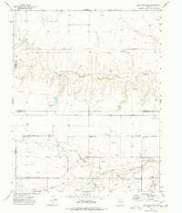
1974 Map of Capps Switch SE
USGS Topo · Published 1977About this map
The rugged break of the Texas Panhandle landscape defines this 1974 survey, where the North Palo Duro Creek and South Palo Duro Creek carve deep through the plains of the High Plains. This territory, spanning the intersections of Sherman, Hansford, Moore, and Hutchinson counties, is dominated by the mid-century energy economy, evidenced by a dense Oil Field and numerous scattered Gas Wells and Oil Wells. The small settlement of Morse sits atop the plateau, serving as a focal point for the regional transit and infrastructure that supports these rural extraction industries.
Find a feature on this map
16 named features on this map. Tap any name to fly to it.
Don’t see what you’re looking for? This feature index may not catch every label — zoom into the map to look around manually.
Map Details
Editions of this 1974 Capps Switch SE Map
This is the sole edition of this map. No revisions or reprints were ever made.
Other maps of this area

1953 · Pringle
USGS Topo · 1:24,000

1954 · Perryton
USGS Topo · 1:250,000

1954 · Amarillo
USGS Topo · 1:250,000

1958 · Perryton
USGS Topo · 1:250,000

1958 · Amarillo
USGS Topo · 1:250,000

1972 · Capps Switch
USGS Topo · 1:24,000
1972 · Pollard Creek NW
USGS Topo · 1:24,000

1974 · Morse
USGS Topo · 1:24,000
1974 · Pollard Creek NE
USGS Topo · 1:24,000

1974 · Hannas Draw East
USGS Topo · 1:24,000