
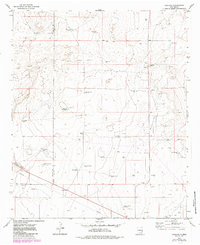
1973 Map of Caprock
USGS Topo · Published 1976About this map
The high plains of eastern New Mexico's Caprock Ranch define this landscape as it appeared in the early 1970s. This survey records a transition from the level terrain of the high mesa to the escarpment and breaks below, a region where large-scale cattle ranching and modern resource extraction converge. The terrain is marked by a network of fence lines and windmills essential for livestock management in a semi-arid environment, contrasted with the industrial footprint of the Mescalero Oil Field. The map meticulously plots drill holes, gravel pits, and pipeline corridors that trace the mid-century development of Lea County’s energy infrastructure alongside traditional ranching operations.
Find a feature on this map
1 named feature on this map. Tap any name to fly to it.
Don’t see what you’re looking for? This feature index may not catch every label — zoom into the map to look around manually.
Map Details
Editions of this 1973 Caprock Map
2 editions found
Other maps of this area

1954 · Brownfield
USGS Topo · 1:250,000

1958 · Brownfield
USGS Topo · 1:250,000

1962 · Brownfield
USGS Topo · 1:250,000

1973 · Mescalero Point
USGS Topo · 1:24,000

1973 · Soldier Hill
USGS Topo · 1:24,000

1973 · Mescalero Point NE
USGS Topo · 1:24,000
1973 · Lane Salt Lake
USGS Topo · 1:24,000
1973 · Dallas Store
USGS Topo · 1:24,000

1978 · Flying M Ranch
USGS Topo · 1:24,000
1979 · Curlew Lake SE
USGS Topo · 1:24,000