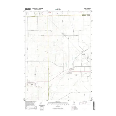
2015 Map of Capron
USGS Topo · Published 2015About this map
The borderlands of northern Illinois and southern Wisconsin come into focus along State Line Rd, where the agricultural landscapes of Boone Co and McHenry Co meet Walworth Co. This 2015 survey details a series of historic village centers including Capron, Chemung, Lawrence, and the western edge of Harvard. The terrain is defined by the winding paths of Piscasaw Creek and its tributaries, such as Mokeler Cr and Lawrence Cr, which have historically influenced the siting of early settlements and roads.
Find a feature on this map
80 named features on this map. Tap any name to fly to it.
Don’t see what you’re looking for? This feature index may not catch every label — zoom into the map to look around manually.
Map Details
Editions of this 2015 Capron Map
This is the sole edition of this map. No revisions or reprints were ever made.
Other maps of this area

1893 · Delavan
USGS Topo · 1:62,500

1893 · Shopiere
USGS Topo · 1:62,500

1918 · Belvidere
USGS Topo · 1:62,500

1932 · Harvard
USGS Topo · 1:48,000

1937 · Harvard
USGS Topo · 1:62,500

1944 · Belvidere
USGS Topo · 1:62,500

1954 · Rockford
USGS Topo · 1:250,000

1955 · Rockford
USGS Topo · 1:250,000

1958 · Rockford
USGS Topo · 1:250,000
1960 · Delavan
USGS Topo · 1:62,500