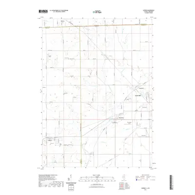
2021 Map of Capron
USGS Topo · Published 2021About this map
Piscasaw Creek and its many tributaries, including W Br Piscasaw Creek and Lawrence Creek, define the rural landscape along the Illinois and Wisconsin border. The area is anchored by the larger community of Harvard in the east and Capron in the southwest, with smaller settlements like Chemung and Lawrence situated along the drainage of Mokeler Creek. This 2021 survey illustrates a region where family history is deeply rooted, evidenced by the numerous small burial grounds scattered across the townships, such as Burr Oak Cemetery, Dullam Cemetery, and Long Prairie Cemetery. Small-scale aviation is a notable characteristic of this landscape, with private facilities like Pine Hill Airport, Twin Gardens Airport, and Dacy Airport dotting the countryside. The map also records the precise path of State Line Road, marking the boundary between Walworth, Boone, and McHenry counties.
Find a feature on this map
83 named features on this map. Tap any name to fly to it.
Don’t see what you’re looking for? This feature index may not catch every label — zoom into the map to look around manually.
Map Details
Editions of this 2021 Capron Map
This is the sole edition of this map. No revisions or reprints were ever made.
Other maps of this area

1893 · Delavan
USGS Topo · 1:62,500

1893 · Shopiere
USGS Topo · 1:62,500

1918 · Belvidere
USGS Topo · 1:62,500

1932 · Harvard
USGS Topo · 1:48,000

1937 · Harvard
USGS Topo · 1:62,500

1944 · Belvidere
USGS Topo · 1:62,500

1954 · Rockford
USGS Topo · 1:250,000

1955 · Rockford
USGS Topo · 1:250,000

1958 · Rockford
USGS Topo · 1:250,000
1960 · Delavan
USGS Topo · 1:62,500