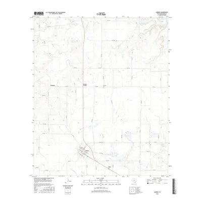
2016 Map of Carbon
USGS Topo · Published 2016About this map
Carbon sits at the heart of this Eastland County landscape, defined by a street grid that reflects the area's coal mining heritage with names like Anthracite St, E Coal St, and Cannell St. The town serves as a hub for a network of country roads connecting small settlements and rural landmarks, including the outlying communities of Mangum and Punkin Center.
Find a feature on this map
62 named features on this map. Tap any name to fly to it.
Don’t see what you’re looking for? This feature index may not catch every label — zoom into the map to look around manually.
Map Details
Editions of this 2016 Carbon Map
This is the sole edition of this map. No revisions or reprints were ever made.
Other maps of this area

1894 · Eastland
USGS Topo · 1:125,000

1954 · Abilene
USGS Topo · 1:250,000

1958 · Abilene
USGS Topo · 1:250,000

1966 · Cisco North
USGS Topo · 1:24,000

1966 · Kokomo
USGS Topo · 1:24,000

1966 · Carbon
USGS Topo · 1:24,000

1966 · Eastland
USGS Topo · 1:24,000

1966 · Cisco South
USGS Topo · 1:24,000

1966 · Ranger
USGS Topo · 1:24,000
1968 · Gorman
USGS Topo · 1:24,000