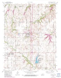
1955 Map of Carbondale
USGS Topo · Published 1983About this map
The Atchison Topeka and Santa Fe railroad serves as the industrial spine for this portion of the Kansas plains, connecting the coal-mining and agricultural communities of Carbondale and Scranton. The landscape is heavily defined by its 1950s resource extraction and water management, evidenced by a Quarry west of town and a large Strip Mine to the east. Local history is deeply etched into the township lines, where small rural education centers like Towhead Sch and the Rubow Sch once anchored the farming population.
Find a feature on this map
30 named features on this map. Tap any name to fly to it.
Don’t see what you’re looking for? This feature index may not catch every label — zoom into the map to look around manually.
Map Details
Editions of this 1955 Carbondale Map
3 editions found
Other maps of this area

1889 · Burlingame
USGS Topo · 1:125,000

1894 · Burlingame
USGS Topo · 1:125,000

1947 · Lawrence
USGS Topo · 1:250,000

1950 · Lawrence
USGS Topo · 1:250,000

1952 · Auburn
USGS Topo · 1:24,000

1952 · Burlingame
USGS Topo · 1:24,000
1955 · Wakarusa
USGS Topo · 1:24,000

1955 · Overbrook
USGS Topo · 1:24,000

1955 · Carbondale
USGS Topo · 1:24,000
1955 · Richland
USGS Topo · 1:24,000