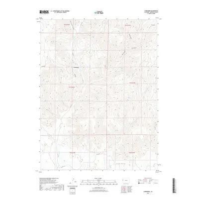
2019 Map of Carbonera
USGS Topo · Published 2019About this map
Carbonera sits at the junction of Buniger Rd and CO Hwy 201, anchoring a landscape defined by the deep drainage systems of the western Colorado plateau. The seasonal flow of W Salt Cr carves a path through the center of the terrain, eventually leading toward the broader Grand Valley to the south. This area is characterized by a dense network of canyons and washes, including Buttermilk Canyon, Spring Canyon, and Dry Canyon Wash, which reveal the erosive patterns of the high desert environment. To the northeast, the elevation rises toward the prominent Grassy Mtn. The grid of township and range lines, such as t7s r104w, imposes a geometric order over the irregular natural features of the land, while roads like Mitchell Rd follow the more level contours of the valley floors.
Find a feature on this map
19 named features on this map. Tap any name to fly to it.
Don’t see what you’re looking for? This feature index may not catch every label — zoom into the map to look around manually.
Map Details
Editions of this 2019 Carbonera Map
This is the sole edition of this map. No revisions or reprints were ever made.
Other maps of this area

1885 · East Tavaputs
USGS Topo · 1:250,000

1956 · Grand Junction
USGS Topo · 1:250,000

1959 · Grand Junction
USGS Topo · 1:250,000

1960 · Grand Junction
USGS Topo · 1:250,000

1962 · Grand Junction
USGS Topo · 1:250,000

1964 · Grand Junction
USGS Topo · 1:250,000

1964 · Douglas Pass
USGS Topo · 1:24,000

1964 · Baxter Pass
USGS Topo · 1:24,000

1965 · Grand Junction
USGS Topo · 1:250,000
1966 · Rat Hole Ridge
USGS Topo · 1:24,000