
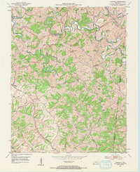
1953 Map of Cardwell
USGS Topo · Published 1954About this map
The Chaplin River carves a deep, meandering path across this mid-century survey of the Washington and Mercer County border. This drainage pattern dictates the placement of early rural settlements, with Sharpsville and Tatham Springs established near the river's bends. The landscape is characterized by a high density of family cemeteries and small rural institutions, including the Masters Cem, Atkinson Cem, and Mt Freedom Ch. These scattered landmarks reflect a settlement pattern of decentralized farming communities connected by winding ridge roads.
Find a feature on this map
43 named features on this map. Tap any name to fly to it.
Don’t see what you’re looking for? This feature index may not catch every label — zoom into the map to look around manually.
Map Details
Editions of this 1953 Cardwell Map
2 editions found
Other maps of this area

1905 · Harrodsburg
USGS Topo · 1:125,000

1952 · Perryville
USGS Topo · 1:24,000

1952 · Cornishville
USGS Topo · 1:24,000

1952 · Ashbrook
USGS Topo · 1:24,000

1952 · Chaplin
USGS Topo · 1:24,000

1952 · Mc Brayer
USGS Topo · 1:24,000

1953 · Mackville
USGS Topo · 1:24,000

1953 · Brush Grove
USGS Topo · 1:24,000

1953 · Springfield
USGS Topo · 1:24,000

1957 · Winchester
USGS Topo · 1:250,000