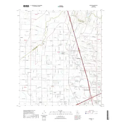
2018 Map of Carencro
USGS Topo · Published 2018About this map
Carencro and the northern reaches of Lafayette anchor this 2018 survey of the Acadiana landscape, where residential expansion increasingly meets a network of natural coulees. The terrain is defined by drainage patterns like Francois Coulee and Coulee Mine, which move water through a region historically shaped by its proximity to the St. Landry Parish and Lafayette Parish line. Local history and genealogy are anchored by landmarks such as Holy Sepulchre Cem and the Green Lawn Memorial Park Cemetery. The map documents a mix of legacy settlements such as Ossun, Vatican, and Cankton alongside modern industrial infrastructure like the Industrial Helicopters Inc Airport. This survey provides a precise account of the road network, from rural routes like Rue Scholastique to the major artery of the NE Evangeline Throughway.
Find a feature on this map
152 named features on this map. Tap any name to fly to it.
Don’t see what you’re looking for? This feature index may not catch every label — zoom into the map to look around manually.
Map Details
Editions of this 2018 Carencro Map
This is the sole edition of this map. No revisions or reprints were ever made.
Other maps of this area

1934 · Duson
USGS Topo · 1:31,680

1939 · St. Martinsville
USGS Topo · 1:62,500

1940 · Arnaudville
USGS Topo · 1:62,500

1946 · Lafayette
USGS Topo · 1:31,680

1952 · Lake Charles
USGS Topo · 1:250,000

1954 · Lafayette
USGS Topo · 1:31,680

1954 · Duson
USGS Topo · 1:31,680

1954 · Lake Charles
USGS Topo · 1:250,000

1954 · Baton Rouge
USGS Topo · 1:250,000

1955 · Lafayette
USGS Topo · 1:24,000