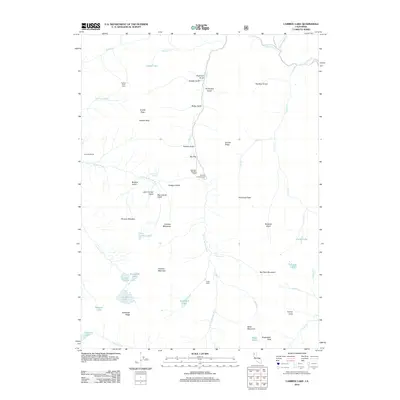
2012 Map of Caribou Lake
USGS Topo · Published 2012About this map
Lakeview Ranch and Mountain Meadow Ranch mark the limited human footprint in this high-altitude landscape of Siskiyou County, where water and elevation dictate the terrain's character. The drainage of the S Fork Salmon River and its numerous tributaries, such as Coffee Cr and Caribou Creek, carve through a series of prominent peaks and ridges. High alpine basins host a cluster of glacial lakes including Caribou Lake, Josephine Lake, and Ward Lake, which are shadowed by the dramatic heights of Caribou Mountain and the Sawtooth Ridge. Remote outposts like Packers Peak Cabin and Carter Cabin indicate a history of forestry or pack-trail operations, while Big Flat Campground serves as a modern access point near the confluence of Packers Gulch and the river. The concentration of gulches like Poorman Gulch and Petrified Gulch suggests a landscape shaped by both geological history and the search for minerals.
Find a feature on this map
56 named features on this map. Tap any name to fly to it.
Don’t see what you’re looking for? This feature index may not catch every label — zoom into the map to look around manually.
Map Details
Editions of this 2012 Caribou Lake Map
This is the sole edition of this map. No revisions or reprints were ever made.
Other maps of this area

1886 · Shasta
USGS Topo · 1:250,000

1890 · Red Bluff
USGS Topo · 1:250,000

1894 · Red Bluff
USGS Topo · 1:250,000

1894 · Shasta
USGS Topo · 1:250,000

1909 · Big Bar
USGS Topo · 1:96,000

1913 · Weaverville
USGS Topo · 1:125,000

1915 · Big Bar and Vicinity
USGS Topo · 1:250,000

1923 · Sawyers Bar
USGS Topo · 1:125,000

1931 · Etna
USGS Topo · 1:96,000

1934 · Etna
USGS Topo · 1:125,000