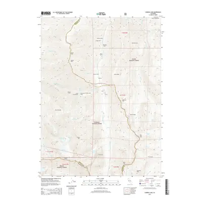
2015 Map of Caribou Lake
USGS Topo · Published 2015About this map
Caribou Lake and the surrounding high-elevation basins of the Trinity Alps define this corner of the Salmon Mountains where Siskiyou Co and Trinity Co meet. The landscape is characterized by a high density of alpine lakes, including Snowslide Lake, Lower Caribou Lake, and Emerald Lake, many of which feed the headwaters of the S Fork Salmon River and Stuart Fork. This 2015 survey illustrates the primitive infrastructure within the Shasta National Forest and Klamath National Forest, where travel is largely limited to forest roads like 39n57 serving the area around Big Flat. Numerous named gulches such as Poorman Gulch and Petrified Gulch score the steep terrain between peaks like Preachers Peak and Packers Peak. The map provides a detailed view of the natural water distribution and drainage patterns across the high ridges of Sawtooth Ridge and Caribou Mtn.
Find a feature on this map
64 named features on this map. Tap any name to fly to it.
Don’t see what you’re looking for? This feature index may not catch every label — zoom into the map to look around manually.
Map Details
Editions of this 2015 Caribou Lake Map
This is the sole edition of this map. No revisions or reprints were ever made.
Other maps of this area

1886 · Shasta
USGS Topo · 1:250,000

1890 · Red Bluff
USGS Topo · 1:250,000

1894 · Red Bluff
USGS Topo · 1:250,000

1894 · Shasta
USGS Topo · 1:250,000

1909 · Big Bar
USGS Topo · 1:96,000

1913 · Weaverville
USGS Topo · 1:125,000

1915 · Big Bar and Vicinity
USGS Topo · 1:250,000

1923 · Sawyers Bar
USGS Topo · 1:125,000

1931 · Etna
USGS Topo · 1:96,000

1934 · Etna
USGS Topo · 1:125,000