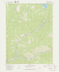
1979 Map of Caribou
USGS Topo · Published 1979About this map
Rich Bar and Belden anchor this detailed study of the Feather River canyon during the late 1970s. The landscape is defined by the heavy engineering of the Western Pacific railroad and complex hydroelectric infrastructure, including the Belden Forebay, multiple Gaging Stations, and an extensive system of tunnels such as Tunnel 24 and Tunnel 25. The industrial presence of the Red Rock Mine contrasts with the recreational development of the Lassen National Forest and Plumas National Forest.
Find a feature on this map
65 named features on this map. Tap any name to fly to it.
Don’t see what you’re looking for? This feature index may not catch every label — zoom into the map to look around manually.
Map Details
Editions of this 1979 Caribou Map
4 editions found
Other maps of this area

1886 · Lassen Peak
USGS Topo · 1:250,000

1888 · Bidwell Bar
USGS Topo · 1:125,000

1891 · Bidwell Bar
USGS Topo · 1:125,000

1892 · Lassen Peak
USGS Topo · 1:250,000

1893 · Bidwell Bar
USGS Topo · 1:125,000

1894 · Lassen Peak
USGS Topo · 1:250,000

1895 · Bidwell Bar
USGS Topo · 1:125,000

1897 · Bidwell Bar
USGS Topo · 1:125,000

1950 · Bucks Lake
USGS Topo · 1:62,500

1955 · Almanor
USGS Topo · 1:62,500