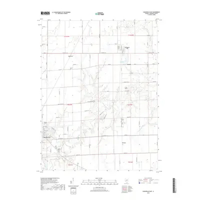
2018 Map of Carlinville East
USGS Topo · Published 2018About this map
The eastern edges of Carlinville meet the agricultural heart of Macoupin County in this 2018 survey, characterized by the winding path of Macoupin Creek and its many tributaries like Hurricane Cr and Sugar Cr. The map captures the campus of Blackburn College on the western margin, serving as a landmark anchor for the region. To the north, the small grid of Standard City and the community of Anderson are surrounded by a network of rural routes and farmsteads. Local history is deeply embedded in the landscape through numerous family and community burial grounds, including the Rural Methodist Cem, Gray Family Cem, and New Calvary Cem. The terrain is marked by notable elevations such as Coops Mound, providing a clear view of the drainage patterns that feed into Standard City Lake and Denbys Pond.
Find a feature on this map
71 named features on this map. Tap any name to fly to it.
Don’t see what you’re looking for? This feature index may not catch every label — zoom into the map to look around manually.
Map Details
Editions of this 2018 Carlinville East Map
This is the sole edition of this map. No revisions or reprints were ever made.
Other maps of this area

1912 · Gillespie
USGS Topo · 1:62,500

1915 · Gillespie
USGS Topo · 1:62,500

1915 · Mount Olive
USGS Topo · 1:62,500

1923 · Carlinville
USGS Topo · 1:48,000

1923 · Raymond
USGS Topo · 1:62,500

1925 · Carlinville
USGS Topo · 1:62,500

1925 · Raymond
USGS Topo · 1:62,500

1931 · Carlinville
USGS Topo · 1:62,500

1944 · Mount Olive
USGS Topo · 1:62,500

1958 · Decatur
USGS Topo · 1:250,000