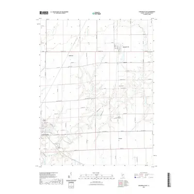
2021 Map of Carlinville East
USGS Topo · Published 2021About this map
Carlinville and its eastern surroundings in Macoupin County are defined by the winding course of Macoupin Creek, which carves through the central landscape. The city itself is anchored by the campus of Blackburn College near its northeastern edge, while the surrounding countryside is dotted with small settlements like Standard City, Schoper, and Womac. This area shows a high density of small family and community burial grounds, including the Gray Family Cem, Davis Cem, and Moore Cem, which provide significant data points for genealogical research in this part of Illinois.
Find a feature on this map
65 named features on this map. Tap any name to fly to it.
Don’t see what you’re looking for? This feature index may not catch every label — zoom into the map to look around manually.
Map Details
Editions of this 2021 Carlinville East Map
This is the sole edition of this map. No revisions or reprints were ever made.
Other maps of this area

1912 · Gillespie
USGS Topo · 1:62,500

1915 · Gillespie
USGS Topo · 1:62,500

1915 · Mount Olive
USGS Topo · 1:62,500

1923 · Carlinville
USGS Topo · 1:48,000

1923 · Raymond
USGS Topo · 1:62,500

1925 · Carlinville
USGS Topo · 1:62,500

1925 · Raymond
USGS Topo · 1:62,500

1931 · Carlinville
USGS Topo · 1:62,500

1944 · Mount Olive
USGS Topo · 1:62,500

1958 · Decatur
USGS Topo · 1:250,000