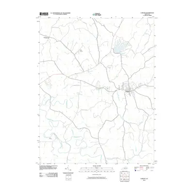
2010 Map of Carlisle
USGS Topo · Published 2010About this map
The city of Carlisle serves as the primary hub in this central Kentucky landscape, where a dense network of country roads connects scattered farmsteads and rural cemeteries. The area is defined by a complex drainage system, notably Hinkston Creek and the various branches of Brushy Creek, which carve through the terrain. Evidence of early paths and settlement patterns is visible in the names of thoroughfares like Buffalo Trace Rd and Youngs Mill Rd. For genealogists, the map identifies specific burial grounds including Mount Carmel Cemetery near the northern reaches and Stoker Cemetery to the southwest. To the northwest, the small community of Headquarters sits along the road network leading toward Wilbur Run. The map illustrates a transitional landscape where established local roads like Lower Concord Rd and Mount Carmel Rd frame the rural space between these historic Kentucky settlements.
Find a feature on this map
28 named features on this map. Tap any name to fly to it.
Don’t see what you’re looking for? This feature index may not catch every label — zoom into the map to look around manually.
Map Details
Editions of this 2010 Carlisle Map
This is the sole edition of this map. No revisions or reprints were ever made.
Other maps of this area

1952 · Cowan
USGS Topo · 1:24,000

1952 · Sharpsburg
USGS Topo · 1:24,000

1952 · Paris East
USGS Topo · 1:24,000

1952 · North Middletown
USGS Topo · 1:24,000

1952 · Piqua
USGS Topo · 1:24,000

1952 · Shady Nook
USGS Topo · 1:24,000

1953 · Carlisle
USGS Topo · 1:24,000

1953 · Moorefield
USGS Topo · 1:24,000

1953 · Millersburg
USGS Topo · 1:24,000

1956 · Louisville
USGS Topo · 1:250,000