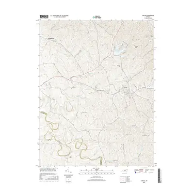
2016 Map of Carlisle
USGS Topo · Published 2016About this map
Carlisle serves as the primary hub in this portion of the Bluegrass region, situated atop the undulating terrain of Nicholas County. The landscape is defined by the winding course of Hinkston Creek and its many tributaries, including McBrides Run and Brushy Fork. Cultural history is well-preserved through numerous family and community burial grounds, such as Stoker Cem and Mount Carmel Cem. The road network, featuring routes like Maysville Rd and Paris Ln, connects smaller settlements like Headquarters to the county seat. Prominent geographical landmarks such as Cane Ridge and Gallows Hill punctuate the ridges between the deep creek valleys. North of the city, Lake Cannigo sits near Hickory Ridge, reflecting the area's development of water resources alongside its traditional agricultural character. This survey captures a rural Kentucky landscape where modern infrastructure aligns with 19th-century settlement patterns.
Find a feature on this map
54 named features on this map. Tap any name to fly to it.
Don’t see what you’re looking for? This feature index may not catch every label — zoom into the map to look around manually.
Map Details
Editions of this 2016 Carlisle Map
This is the sole edition of this map. No revisions or reprints were ever made.
Other maps of this area

1952 · Cowan
USGS Topo · 1:24,000

1952 · Sharpsburg
USGS Topo · 1:24,000

1952 · Paris East
USGS Topo · 1:24,000

1952 · North Middletown
USGS Topo · 1:24,000

1952 · Piqua
USGS Topo · 1:24,000

1952 · Shady Nook
USGS Topo · 1:24,000

1953 · Carlisle
USGS Topo · 1:24,000

1953 · Moorefield
USGS Topo · 1:24,000

1953 · Millersburg
USGS Topo · 1:24,000

1956 · Louisville
USGS Topo · 1:250,000