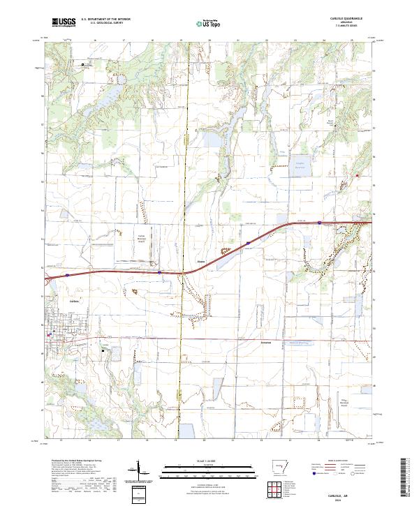
2024 Map of Carlisle
USGS Topo · Published 2024About this map
Carlisle and Hazen anchor this Arkansas Grand Prairie landscape, where the flat agricultural terrain is defined by a complex network of bayous and drainage systems. The survey details the transition between the Lonoke and Prairie County line, showcasing how irrigation and water management shaped the region. Notable water features like La Grue Bayou and Bayou Two Prairie frame the agricultural blocks, while man-made landmarks such as Vaughts Reservoir and Lake Treadway illustrate the local reliance on water storage. For genealogists and local historians, the map identifies specific burial sites including Carlisle Cem, Mount Pleasant Cem, and Mount Zion Cem. Small settlements like Screeton remain visible along the primary transportation corridors that connect these rural communities.
Find a feature on this map
90 named features on this map. Tap any name to fly to it.
Don’t see what you’re looking for? This feature index may not catch every label — zoom into the map to look around manually.
Map Details
Editions of this 2024 Carlisle Map
This is the sole edition of this map. No revisions or reprints were ever made.
Other maps of this area

1935 · Hazen
USGS Topo · 1:62,500

1937 · Stuttgart
USGS Topo · 1:62,500

1937 · England
USGS Topo · 1:48,000

1939 · Stuttgart
USGS Topo · 1:62,500

1940 · Lonoke
USGS Topo · 1:62,500

1941 · Hazen
USGS Topo · 1:62,500

1943 · England
USGS Topo · 1:62,500

1948 · Helena
USGS Topo · 1:250,000

1949 · Lonoke
USGS Topo · 1:62,500

1950 · Helena
USGS Topo · 1:250,000