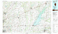
1985 Map of Carlyle Lake
USGS Topo · Published 1988About this map
The massive expanse of Carlyle Lake dominates this 1980s landscape, serving as a focal point for conservation and recreation in central Illinois. Flanking the water are significant protected lands including the Carlyle Lake State Wildlife Management Area, Hazlet State Park, and South Shore State Park. To the west, the intensifying suburban and military presence of the Metro East area is anchored by Scott Air Force Base and the historic campus of McKendree College in Lebanon.
Find a feature on this map
96 named features on this map. Tap any name to fly to it.
Don’t see what you’re looking for? This feature index may not catch every label — zoom into the map to look around manually.
Map Details
Editions of this 1985 Carlyle Lake Map
2 editions found
Other maps of this area

1888 · St. Louis
USGS Topo · 1:62,500

1906 · Breese
USGS Topo · 1:62,500

1907 · Breese
USGS Topo · 1:62,500

1907 · Belleville
USGS Topo · 1:62,500

1910 · Carlyle
USGS Topo · 1:62,500

1910 · Okawville
USGS Topo · 1:62,500

1910 · Waterloo
USGS Topo · 1:62,500

1912 · New Athens
USGS Topo · 1:62,500

1912 · Gillespie
USGS Topo · 1:62,500

1913 · Waterloo
USGS Topo · 1:62,500