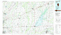
1985 Map of Carlyle Lake
USGS Topo · Published 1985About this map
Carlyle Lake and the expansive Kaskaskia River basin anchor this mid-1980s survey of southwestern Illinois. The landscape is a study in post-war suburban expansion and vital infrastructure, showing the dense residential clusters of Belleville, Edwardsville, and Collinsville contrasted against the managed wilderness of the Carlyle Lake State Fish and Wildlife Management Area. Higher education and military presence are prominent, with Southern Illinois Univ (Edwardsville), McKendree College, and the sprawling grounds of Scott Air Force Base serving as regional landmarks.
Find a feature on this map
136 named features on this map. Tap any name to fly to it.
Don’t see what you’re looking for? This feature index may not catch every label — zoom into the map to look around manually.
Map Details
Editions of this 1985 Carlyle Lake Map
2 editions found
Other maps of this area

1888 · St. Louis
USGS Topo · 1:62,500

1906 · Breese
USGS Topo · 1:62,500

1907 · Breese
USGS Topo · 1:62,500

1907 · Belleville
USGS Topo · 1:62,500

1910 · Carlyle
USGS Topo · 1:62,500

1910 · Okawville
USGS Topo · 1:62,500

1910 · Waterloo
USGS Topo · 1:62,500

1912 · New Athens
USGS Topo · 1:62,500

1912 · Gillespie
USGS Topo · 1:62,500

1913 · Waterloo
USGS Topo · 1:62,500