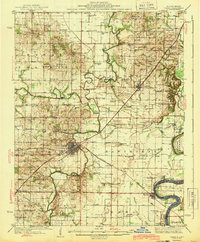
1943 Map of Carmi
USGS Topo · Published 1943About this map
Carmi serves as the focal point of this Southern Illinois landscape, where the confluence of the Little Wabash River and Skillet Fork dictates the pattern of settlement. In the early 1940s, the area was densely populated with rural institutions, including the Baptist Orphanage south of the main town and dozens of uniquely named schoolhouses like Moccasin Sch and Bootjack Sch. The infrastructure of the era is clearly defined by the New York Central and Louisville and Nashville railroads, which facilitated local trade for communities such as Crossville and Phillipstown.
Find a feature on this map
100 named features on this map. Tap any name to fly to it.
Don’t see what you’re looking for? This feature index may not catch every label — zoom into the map to look around manually.
Map Details
Editions of this 1943 Carmi Map
2 editions found

Other maps of this area

1903 · New Harmony
USGS Topo · 1:62,500

1903 · Patoka
USGS Topo · 1:125,000

1904 · Mount Carmel
USGS Topo · 1:62,500

1905 · Eldorado
USGS Topo · 1:62,500

1905 · New Haven
USGS Topo · 1:62,500

1906 · New Haven
USGS Topo · 1:62,500

1906 · Eldorado
USGS Topo · 1:62,500

1917 · Uniontown
USGS Topo · 1:62,500

1938 · New Harmony
USGS Topo · 1:62,500

1940 · Carmi
USGS Topo · 1:62,500